0 COUNTY RD NORTH OF
Owner Information
MAHONEY DENNIS & SONS INC
P O BOX 417
MATTAPOISETT, MA 02739


Property Details
0 COUNTY RD NORTH OF is classified as a Undevelopable Residential Land (Vacant land).
0 COUNTY RD NORTH OF is valued at $42,600. The land is valued at $42,600 and the structures are valued at $0.
This property is in Zone GB. Confirm with local Zoning Board authorities to ensure there are no overlays or other easements on this property.
The most recent deed for 0 COUNTY RD NORTH OF is recorded at the local registrar in Book 3348, Page 226. 0 COUNTY RD NORTH OF was last sold on Friday, February 10, 1967 for $0.
Assessment data from fiscal year 2022.
Flood Data
According to the FEMA National Flood Hazard Layer, this property does not appear to be in a flood zone. It may also be in an area not yet reviewed. Nonetheless, confirm this information prior to taking any action.
To view the flood hazards around this property, create a FEMA "Firmette" Map of the area around 0 COUNTY RD NORTH OF.
Broadband Internet Providers
| Provider | Type | Bandwidth (mbps) | |
|---|---|---|---|
| PAETEC Communications, Inc | DSL | 0 | 0 |
| Comcast | Cable | 1000 | 35 |
| Verizon New England Inc. | Fiber | 940 | 880 |
| Verizon New England Inc. | DSL | 15 | 1 |
| Viasat Inc | Satellite | 35 | 3 |
| MCI | Copper Wire | 0 | 0 |
| HughesNet | Satellite | 25 | 3 |
| VSAT Systems, LLC. | Satellite | 2 | 1 |
| GCI Communication Corp. | Satellite | 0 | 0 |
| PAETEC Communications, Inc | Fiber | 0 | 0 |
Broadband service provider data from December 2020.
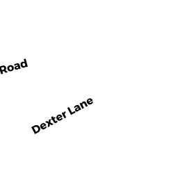
Adjacent Properties
- 0 BAY CLUB DR
Hiking - trails or paths (Ch. 61B, not classified as OS) owned by BAY CLUB COMMUNITY ASSOC., INC - 52 NORTH ST
Single Family Residential owned by HEALD CANDACE L TRUSTEE OF THE - 51 COUNTY RD
Small Retail and Services stores (under 10,000 sq. ft.) owned by 7 ELEVEN INC - 53 COUNTY RD
General Office Buildings owned by DUNN GAIL W TRS - 55 COUNTY RD
General Office Buildings owned by DUNN GAIL W TRS - 0 COUNTY RD NORTH OF
Undevelopable Residential Land owned by DUNN GAIL W